[DESNOS, Louis Charles].
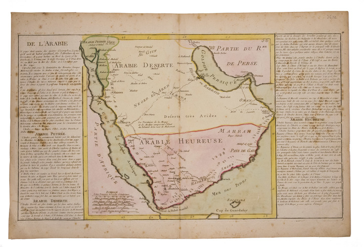
De l'Arabie.
[Paris, ca. 1760]. Engraved map (plate size: 31.5 x 54.5), coloured by a contemporary hand, with 6 scale bars at the foot left, and the map with engraved text on the left and right containing a description of Arabia. On laid paper (37.5 x 56.5).
€ 950
Engraved map of the Arabian peninsula, coloured by hand and flanked by a description. The book is attributed in Al Qassimi to the Parisian map publisher Louis Charles Desnos, Al Ankary however attributes it to Jean-Baptiste Louis Claudette, who appears to be solely known from this attribution. The map was likely published for an atlas as indicated by the number "56" at the head right (the copy in Al Ankary has the number "52").
Some minor foxing, mostly affecting the text and margins, but otherwise in good condition. Al Ankary, p. 367; Al Qassimi (1999), p. 204.
Related Subjects: