WERDECKER, Josef.
A contribution to the geography and cartography of north-west Yemen (based on the results of the exploration by Eduard Glaser, undertaken in the years 1882-1884).
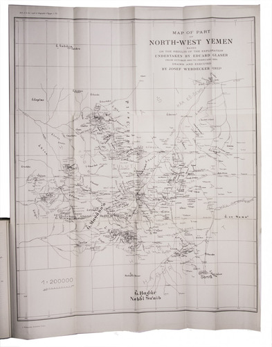
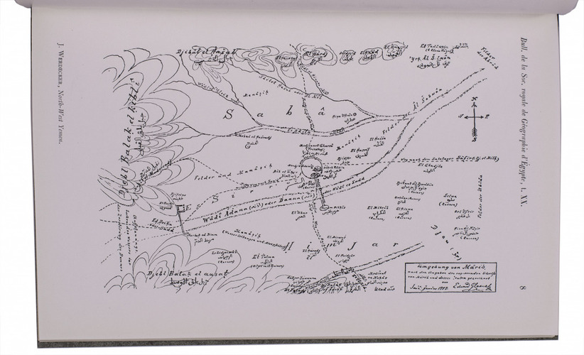
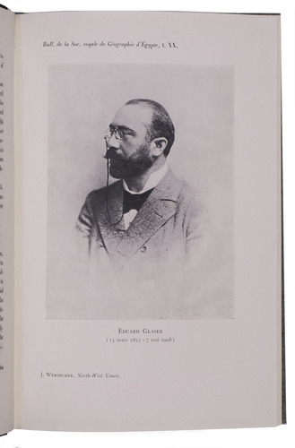
Cairo, lInstitut Français dArchéologie Orientale du Caire, 1939. 8vo. With a portrait of Eduard Glaser, 8 numbered plates and 2 large folding maps. Later half cloth, with the original front wrapper mounted on the front board. [2], 160 pp.
€ 2,800
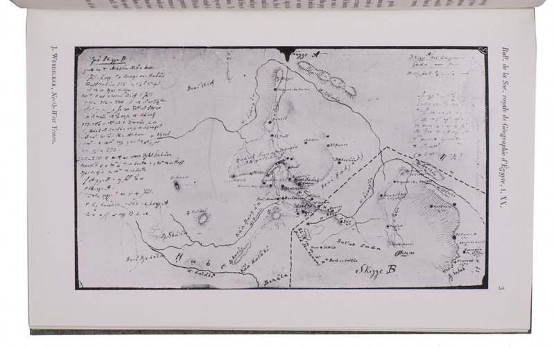
Re offprint of "an extremely important article" (Smith) on the geography of north-west Yemen, based on the results of the unpublished journals of Eduard Glaser, who explored a region that still had to be visited by any other European. It includes a history of exploration of the region, a biography of Glaser, a description of the expedition of his expeditions and two large maps of region (the second a version of the same map in Arabic). The article was originally published in the Bulletin de la Société Royale de Géographie d'Egypte XX.
A very good copy. Smith, The Yemens 40.
Related Subjects: