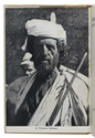

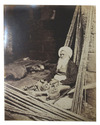
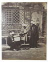
60 photographs by Bechard of Egyptians and Nubians
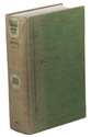
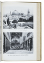
BÉCHARD, Henri
Égypte et Nubie.
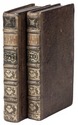
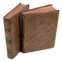
[ca. 1880]. 60 photographs on albumen paper, measuring 28 x 22 cm each, signed and captioned in the plate, numbered 1 through 68. Contemporary green half calf with gilt spine and title "Égypte & Nubie", initialed "B.C.D." on first plate. Full description
€ 45,000
[ca. 1880]. 60 photographs on albumen paper, measuring 28 x 22 cm each, signed and captioned in the plate, numbered 1 through 68. Contemporary green half calf with gilt spine and title "Égypte & Nubie", initialed "B.C.D." on first plate. Full description