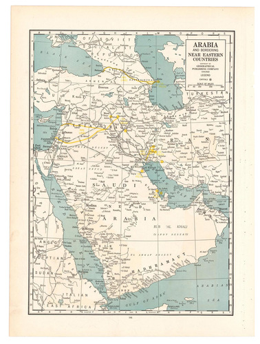
[MAP - MIDDLE EAST]. Geographical Publishing Company.
Arabia and near bordering countries.
Including:
- Palestine
- Iran (Persia) and surrounding territory
Chicago, Geographical publishing company, [ca. 1936-1941]. Colour printed map, 54 x 40 cm.
€ 1,500
Map of the Arabian Peninsula and parts of the USSR, Turkey, Iran and the British, French and Italian colonies in Africa, possibly coming from an edition of the Commercial atlas of the world. Printed in yellow are oil fields and pipelines, including the legendary Kirkuk-Haifa/Tripoli oil pipeline. Detailed maps of Iran and of British controlled Palestine are printed on the other side.
With a few small holes near the inner margin.
Related Subjects: