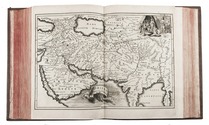

The geographical details of two outstanding maps of Arabia

BERGHAUS, Heinrich.
Geographisches memoir zur erklärung und erlaüterung der Karte von Syrien. (no. 5. von Berghaus' Atlas von Asia).
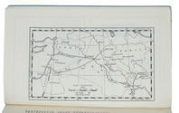
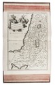
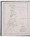
Gotha, Justus Perthes, 1835. With an engraved map of Syria.
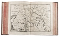
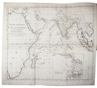
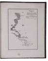
With: (2) BERGHAUS, Heinrich. Geo-hydrographisches memoir zur erklärung und erlaüterung der General-Karte von Arabia und dem Nil-Lande. (no. 6. von Berghaus' Atlas von Asia).
Gotha, Justus Perthes, 1835. 2 works in 1 volume. 4to. With a supplement to another article by Berghaus bound at the end: Supplement zur historisch-geographischen Beschreibung von Assam etc., with an engraved map. Modern half cloth. [4], 48; [4], 128; 179-182 pp. Full description
€ 2,500
Gotha, Justus Perthes, 1835. With an engraved map of Syria.
With: (2) BERGHAUS, Heinrich. Geo-hydrographisches memoir zur erklärung und erlaüterung der General-Karte von Arabia und dem Nil-Lande. (no. 6. von Berghaus' Atlas von Asia).
Gotha, Justus Perthes, 1835. 2 works in 1 volume. 4to. With a supplement to another article by Berghaus bound at the end: Supplement zur historisch-geographischen Beschreibung von Assam etc., with an engraved map. Modern half cloth. [4], 48; [4], 128; 179-182 pp. Full description