Home
Shopping cart (0 items € 0)
Advanced search

With attractive maps of the Holy Land

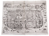
ADRICHEM, Christiaan van. Theatrum Terrae Sanctae et biblicarum historiarum cum tabulis geographicis aere expressis.
[Cologne, Officina Birckmannica, for Hermann Mylius, 1628]. Folio. With engraved allegorical title-page, numerous decorated woodcut initial letters and tailpieces, 11 maps of Israel and 1 map of Jerusalem (8 folding and 4 double-page). Contemporary calf, gold-tooled spine with red morocco title-label, blind-tooled sides, gilt binding edges. [12], 286, [30] pp. Full description
€ 10,000
Order Inquire Terms of sale

Rare and extensive work on Algeria, spectacularly illustrated with 133 large plates, some in colour

BERBRUGGER, Louis Adrien. Algerie historique, pittoresque et monumentale, ou Recueil de vues, costumes et portraits faits d'après nature dans les provinces d'Alger, Bone, Constantine et Oran.
Paris, Delahaye (part-titles: printed by Dondey-Dupré), 1843. 5 parts in 3 volumes. Royal 1mo (57 x 42.5 cm). With chromo-lithographed general title-page, tinted lithographed frontispiece, 2 lithographed maps hand-coloured in outline, and 133 lithographed plates (image size up to 44.5 x 30.5 cm, nearly all non-botanical ones tinted and one with 2 chromolithographed and hand-coloured costume prints) by and after artists including Charles Bour, Eugène Flandin, Félix Emmanuel Henri Philippoteaux and Denis Auguste Marie Raffet. Also with lithographed views (and a few lithographed maps) printed in the tail margins at the ends of many chapters, and 45 white-on-black wood-engravings of coins (each with obverse and reverse) in the text. The 72 botanical illustrations on the last 10 lithographed plates are coloured by hand and highlighted with gum arabic. The non-botanical plates have the publisher's embossed stamp in the foot margin. Contemporary, uniform dark green half goatskin morocco with a gold-tooled spine. XIV, [3], [1 blank], 80; [3], [1 blank], 68; [3], [1 blank], 42; [3], [1 blank], 21, [1 blank], 18, 16, [1], [1 blank] pp. including the chromolithographed title-page. Full description
€ 28,500
Order Inquire Terms of sale

Unique hand-coloured copy of Dapper's famous description of Africa

DAPPER, Olfert. Naukeurige beschrijvinge der Afrikaensche gewesten van Egypten, Barbaryen, Lybien, Biledulgerid, Negroslant, Guinea, Ethiopiën, Abyssinie: vertoont in de benamingen, grenspalen, revieren, steden, gewassen, dieren, zeeden, drachten, talen, rijkdommen, godsdiensten en heerschappyen. ...
Including: Naukeurige beschrijvinge der Afrikaensche eylanden ...
Amsterdam, Jacob van Meurs, 1676. 3 works in 1 volume. Folio (33 x 22 cm). With a richly engraved allegorical frontispiece, a large folding engraved map of Africa (44.5 x 56 cm), 14 double-page engraved maps of parts of Africa and the adjacent islands, 27 double-page and 1 larger folding engraved plates and views, and 55 half-page engraved views, plans, illustrations of costumes, animals, plants, etc. in the text. All illustrations coloured by a contemporary hand. Contemporary vellum at a later date with elaborate blind-tooled decorations, including oriental portraits. With 2 decorated brass clasps, signed B-I. [6], 428, 349, [16]; [1], 121, [4] pp. Full description
€ 85,000
Order Inquire Terms of sale

1565/66 pilgrimage to the Middle East, with author's portrait, coat of arms and 6 illustration plates

FÜRER VON HAIMENDORF, Christoph. Itinerarium Aegypti, Arabiae, Palaestinae, Syriae, aliarumque regionum orientalium.
Nuremberg, Abraham Wagenmann, 1621 (colophon: Nuremberg, printed by Abraham Wagenmann, 1620). Small 4to. With finely engraved full-page portrait of the author by Peter Isselberg, full-page engraved Fürer von Haimendorf coat of arms, 6 folding engraved plates. Contemporary limp sheepskin parchment. [16], 118, [114] pp. Full description
€ 12,500
Order Inquire Terms of sale

Historical narrative of a voyage to India and Persia written by a surgeon of the British Royal Navy

IVES, Edward. Reize naar Oost-Indië en Persië, en de daar omliggende landen. Ondernomen langs een' ongewoonen weg.
Amsterdam, De Compagnie, 1779. 2 volumes bound as 1. 4to. With 2 engraved title-pages, 2 folding engraved maps, one of India (44 x 51 cm), the other tracking Ives's journey from Basra to Latakia (ca. 42 x 56 cm), and 9 engraved plates (including 1 large folding). Early 20th-century boards. [16], 324; [1], [1 blank], [1], [1 blank], 379, [1] pp. Full description
€ 2,950
Order Inquire Terms of sale

Most extensive edition of a monumental, extensively illustrated description of the world

MÜNSTER, Sebastian. Cosmographia, das ist: Beschreibung der gantzen Welt, ...
Basel, heirs of Sebastian Henricpetri, 1628. Folio (38 x 24.5 cm). With engraved title-page, letterpress title-page printed in red and black with woodcut portrait of Münster on the back, 26 numbered double-page woodcut maps on inserted bifolia, 72 double-page woodcut maps, plans and views on integral leaves, and about 1500 woodcut illustrations in the text (including repeats) showing maps, plans, views, plants, animals, monsters, etc. Contemporary vellum. [24], “1752” [=1748] , [12] pp. Full description
€ 48,000
Order Inquire Terms of sale

One of the earliest sources on the Congo and central Africa, complete with all plates and maps

PIGAFETTA, Filippo and Duarte LOPEZ. Relatione del reame di Congo et delle circonvicine contrade tratta dalli scritti & ragionamenti di Odoardo Lopez.
Rome, Bartolomeo Grassi, [1591]. 4to. With an integral engraved architectural title-page (with the coat of arms of the dedicatee Antonio Migliore, Bishop of San Marco), large folding engraved general map of Africa (64×44 cm), large folding engraved map of the Congo (43.5×51.5 cm) and 8 numbered folding engraved plates of plants, animals and inhabitants of the country, by Natalis Bonifazio. Contemporary limp sheepskin parchment. [8], 82, [1], [1 blank] pp. Full description
€ 60,000
Order Inquire Terms of sale

Beautifully coloured composite atlas

[DANCKERTS, ALLARD, VISSCHER, DE WIT, MORTIER and others]. Atlas.
[Amsterdam, Theodorus and Cornelis III Danckerts?, ca. 1706 (dated maps 1694-1706)]. Imperial folio (53.5 x 33.5 cm). Composite atlas, with an engraved title-page, 43 double-page engraved maps and 4 double-page engraved tables, all beautifully coloured in a consistent and balanced manner by a contemporary hand, probably in the workshop of the publisher. With maps by Johannes, Justus, Theodorus and Cornelis III Danckerts, Carel and Abraham Allard, Nicolaas Visscher I & II, Frederik de Wit, Pieter Mortier, Caspar Specht and even Alexis-Hubert Jaillot in Paris. Modern maroon sheepskin. Full description
€ 48,500
Order Inquire Terms of sale

Enormous panoramic Middle Eastern view with ruins, nearly 6 metres long

[VIEW - MIDDLE EAST]. [Mountainous landscape with Middle Eastern and classical Roman ruins, 6 shepherds with their flocks, several figures riding dromedaries and one riding a donkey, (date?) palms, lakes, etc.].
[Palestine?, ca. 1910?]. An enormous panoramic view drawn in coloured gouaches on a single, continuous roll of paper (70 x 583 cm), the drawing running to the edges of the paper. Full description
€ 35,000
Order Inquire Terms of sale
10 books found