
"For Official Use Only."
PAGET, William Henry, MASON, A. H. & others (editors).
Frontier and overseas expeditions from India. Compiled in the intelligence branch of the divisions of the chief of the staff army head quarters India. In six volumes. For official use only.
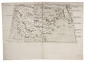
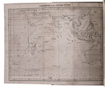
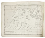
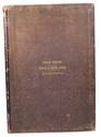
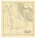
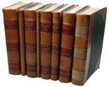
Simla, Government Monotype Press, 1907-1911. 8 volumes (6 plus 2 supplements). 8vo. With 43 maps and 8 plans.
Uniform contemporary half calf, green cloth sides, gold-stamped spine labels. Full description
€ 75,000
Simla, Government Monotype Press, 1907-1911. 8 volumes (6 plus 2 supplements). 8vo. With 43 maps and 8 plans.
Uniform contemporary half calf, green cloth sides, gold-stamped spine labels. Full description