Categories
Shopping cart (0 items € 0)
Advanced search

Middle East & Islamic World / Cartography & Exploration

8 large illustrated volumes of the most important voyages from the 15th to the end of the 17th century

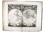
AA, Pieter van der (editor) and Johann Ludwig GOTTFRIED. De aanmerkenswaardigste en alomberoemde zee- en landreizen der Portugeezen, Spanjaarden, Engelsen en allerhande natiën: zoo van Fransen, Italiaanen, Deenen, Hoogh- en Nederduitsen als van veele andere volkeren. Voornaamenlyk ondernomen tot ontdekking van de Oost- en Westindiën, midsgaders andere verafgelegene gewesten des aardryks.
The Hague, widow of Engelbrecht Boucquet and sons; Leiden, Jan van der Deyster, and Boudewijn and Pieter van der Aa, 1727. 8 volumes. 1mo and folio. With 7 (of 8) engraved frontispieces (lacking that of volume 4), 4 engraved dedications, 117 engraved maps on 61 leaves, 7 engraved plates and 502 engravings in text. Further with 127 (of 128) title-pages (including a general title-page, a title-page to 7 (of 8) volumes, lacking that of volume 4, and 118 for the separate works). Volume 1-3 & 5-8: contemporary mottled calf, gold-tooled spine and board edges; volume 4: modern calf. Full description
€ 65,000
Order Inquire Terms of sale

With attractive maps of the Holy Land

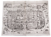
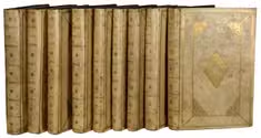
ADRICHEM, Christiaan van. Theatrum Terrae Sanctae et biblicarum historiarum cum tabulis geographicis aere expressis.
[Cologne, Officina Birckmannica, for Hermann Mylius, 1628]. Folio. With engraved allegorical title-page, numerous decorated woodcut initial letters and tailpieces, 11 maps of Israel and 1 map of Jerusalem (8 folding and 4 double-page). Contemporary calf, gold-tooled spine with red morocco title-label, blind-tooled sides, gilt binding edges. [12], 286, [30] pp. Full description
€ 10,000
Order Inquire Terms of sale

Rare travelogue of Yemen, with the original Arabic text

AL-GARADI, Ahmed Ibn Muhammad [and Eugen MITTWOCH]. Aus dem Jemen. Hermann Burchardts letzte Reise durch Südarabien. bearbeitet von Eugen Mittwoch...
Leipzig, Deutsche Morgenländische Gesellschaft in kommission bei F.A. Brockhaus, [1926]. 4to. 28 plates with 55 photos, 1 map on page 9. Text is partially in Arabic. Original paper wrappers. [4], 74 pp. Full description
€ 200
Order Inquire Terms of sale

A large two-sheet map of the Middle East

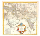
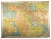
ANVILLE, Jean Baptiste Bourguignon d'. Premier Partie de la Carte d' Asie, contenant La Turquie, L'Arabie, La Perse, L'Inde en deça du Gange et de la Tartarie ce qui est limitrophe de la Pers et du Gange.
Paris, 1751 Engraved map on two sheets (75 x 79 cm), with hand-coloured cartouche and coloured in outline. Full description
€ 950
Order Inquire Terms of sale

Large folding road map of Saudi Arabia

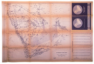
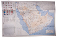
[ARAMCO]. Saudi Arabian road map.
Dammam, Al-Mutawa press company, 1973. Large folding map (60 × 90.5 cm), printed in light orange with darker purple, depicting the Kingdom of Saudi Arabia and its main roads. With on the right the title in both Arabic and English and a table with the distances from one city to another. Full description
€ 1,800
Order Inquire Terms of sale

Surviving traffic in Saudi Arabia, a large folding map

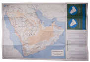
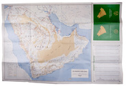
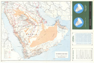
ARAMCO. Saudi Arabian road map.
Dammam, printed by the Al-Mutawa Press for the Arabian American Oil Company, 1973. Large folding map (60 x 90.5 cm), printed in colour, depicting the Kingdom of Saudi Arabia and its main roads. With on the right the title in both Arabic and English and a table with the distances from one city to another. Printed on two sides, one side with the map in English and the other in Arabic. Full description
€ 1,800
Order Inquire Terms of sale

Surviving traffic in Saudi Arabia, a large folding map

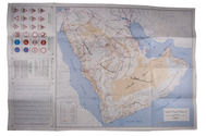
ARAMCO. Saudi Arabian road map.
Dammam, printed by the Al-Mutawa Press for the Arabian American Oil Company, 1975. Large folding map (60 x 90.5 cm), printed in colour, depicting the Kingdom of Saudi Arabia and its main roads. With on the right the title in both Arabic and English and a table with the distances from one city to another. Printed on two sides, one side with the map in English and the other in Arabic. Full description
€ 1,500
Order Inquire Terms of sale

The geographical details of two outstanding maps of Arabia

BERGHAUS, Heinrich. Geographisches memoir zur erklärung und erlaüterung der Karte von Syrien. (no. 5. von Berghaus' Atlas von Asia).
Gotha, Justus Perthes, 1835. With an engraved map of Syria.
With: (2) BERGHAUS, Heinrich. Geo-hydrographisches memoir zur erklärung und erlaüterung der General-Karte von Arabia und dem Nil-Lande. (no. 6. von Berghaus' Atlas von Asia).
Gotha, Justus Perthes, 1835. 2 works in 1 volume. 4to. With a supplement to another article by Berghaus bound at the end: Supplement zur historisch-geographischen Beschreibung von Assam etc., with an engraved map. Modern half cloth. [4], 48; [4], 128; 179-182 pp. Full description
€ 2,500
Order Inquire Terms of sale
103 books found / Show all