Categories
Shopping cart (0 items € 0)
Advanced search

Middle East & Islamic World / Cartography & Exploration

Navigating the Red Sea and Gulf of Aden

[NAVIGATION - RED SEA]. Red Sea and Gulf of Aden pilot comprising the Suez canal, the gulfs of Suez and 'Aqaba, the Red Sea, the Gulf of Aden, ...
Including: Supplement no. 1-1957 relating to the Red Sea and Gulf of Aden pilot, tenth edition ...
London, published by the Hydrographic Department, Admiralty, 1955-1957. 8vo. With a folding map (printed on both sides), 2 coloured plates with diagrams (printed on both sides), 28 plates showing coastlines and occasionally a map (many printed on both sides), and many some illustrations in text. Original blue cloth; supplement with original printed paper wrappers. LI, [1 blank], 518, [1], [1 blank] pp. Full description
€ 1,750
Order Inquire Terms of sale

Important contribution to the study of the Middle East

NIEBUHR, Carsten. Voyage en Arabie & en d'autres pays circonvoisins. Tome premier[- second]. Traduit de l'Allemand.
Amsterdam, Steven Jacobus Baalde; Utrecht, Barthelemy Wild (colophon: printed by Joh. Jos. Besseling, Utrecht, 1775), 1775-1780. 2 volumes. 4to. With 2 engraved integral title-pages, 124 engraved plates (many folding) and a folding map of Yemen (in partial colour). Contemporary gold-tooled calf. VIII, [6], 409, [1], [1 blank]; VI, [10], 389, [1] pp. Full description
€ 6,000
Order Inquire Terms of sale

Rare travel account

OPPENHEIM, Max von. 
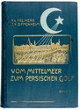
Vom Mittelmeer zum Persischen Golf durch den Hauran, die Syrische Wüste und Mesopotamien.
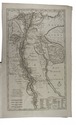
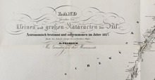
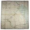
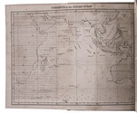
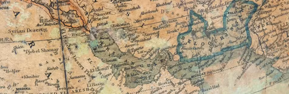
Berlin, Dietrich Reimer, 1899-1900. 2 volumes. Large 8vo. With 2 (of 3) folding maps in pockets on the inside of the back board and numerous illustrations in the text and on photographic plates. Original illustrated green cloth. XV, [1], 334; [1], 434 pp. Full description
€ 8,500
Order Inquire Terms of sale

Only published edition of the original 1521 text of the navigation book of the great Ottoman admiral

PIRI REIS (Paul KAHLE, ed.). Bahrije. Das türkische Segelhandbuch für das Mittelländische Meer vom Jahre 1521.
Berlin and Leipzig, Walter de Gruyter & Co., 1926-1927. 3 volumes. Large 8vo (26 x 18 cm). Volume 1 with 137 reproductions of manuscript pages of Ottoman Turkish text and maps and volume 2 with 4 plates. Publisher's original printed wrappers. [1], [1 blank], [2] pp. + 64 ll. + [4], [1 blank], [1] pp.; ll. 65-137; [1], [1 blank], XLVIII, 88 pp. Full description
€ 2,500
Order Inquire Terms of sale

Augmented Dutch edition of Pocockes celebrated description of the Near and Middle East,
with 205 engraved plates

POCOCKE, Richard. Beschryving van het Oosten, en van eenige andere landen, ...
Utrecht, Gijsbert Tieme and Abraham van Paddenburg; Rotterdam, Jacobus Bosch and Reinier Arrenberg; Amsterdam, Martinus de Bruyn, 1776-1786. 3 volumes (in 6 parts) bound as 6. 4to. With 205 engraved folding plates (irregularly numbered I-CIII), including maps, plans, views and other illustrations, depicting temples, antiquities, plants, animals, etc. Contemporary half calf. XXXVI, 219, [1 blank], [11], 224-491, [1 blank]; [12], 262, [2 blank], VIII, [3], 268-376, 397-519, [1 blank]; VIII, 262, [2 blank], VIII, [3], 268-403, [1 blank]; [4], 115, [1], 124 pp. Full description
€ 15,000
Order Inquire Terms of sale

Important survey of ancient Egyptian and Nubian sites now submerged, with a very large and detailed map: a fine copy, partly unopened

PROKESCH, Anton, Ritter von Osten. Das Land zwischen den Katarakten des Nil. Mit einer Karte, ...
Vienna, Carl Gerold, 1831. 12mo (the book) and 17.5 x 25 cm (the folder with the folded map). With a separate large folding lithographed map (98 x 69 cm; image area 93 x 64 cm) assembled from 2 sheets, with the cultivated areas along the river hand-coloured in green as published, also showing 17 floor plans of temples and a plan of a Roman wall. The book in the publishers original light green paper wrappers and the map in a matching green paper folder. [8], 181, [3 blank] pp. plus folding table and separate map. Full description
€ 3,750
Order Inquire Terms of sale

One of the earliest maps of Arabia, with unique contemporary illumination

[MAP - ARABIAN PENINSULA]. PTOLEMAEUS, Claudius. [Jacobus ANGELUS, trans.; Nicolaus GERMANUS, ed.]. Sexta Asie Tabula.
Ulm, Lienhart Holle, 1482. Oblong 1mo (whole sheet: 41.5 by 57 cm). With a double-page woodcut map. Finely coloured by a contemporary hand, with near-contemporary manuscript vignette illustrations of an Ababeel bird, Makkah (Mecca) and the Kaaba in pen and wash highlighted in gold. Full description
€ 150,000
Order Inquire Terms of sale

A Danish traveller in Kuwait, Saudi-Arabia and Bahrain, meets Mubarak al-Sabah and Ibn Saud, presentation copy

RAUNKIAER, Barclay. Gennem Wahhabiternes land paa kamelryg. Beretning om den af det Kongelige Danske Geografiske Selskab planlagte og bekosterde forskningsrejse i Ost- og Centralarabien 1912.
Copenhagen, Gyldendalske boghandel, Nordisk forlag, 1913. 8vo. With a frontispiece showing the author in Arab garb, 88 illustrations in text, most of them reproductions of drawings and photographs by the author, and a folding map loosely inserted in a pocket at the end. Publisher's green cloth. [1], [1 blank], [2], 304 pp. Full description
€ 5,000
Order Inquire Terms of sale

Travelogue of Arabia by a distinguished Lebanese Arab-American writer, with 32 plates

RIHANI, Ameen. Around the coasts of Arabia.
London, Constable & Co., 1930. 8vo. With a pictorial map as frontispiece, 31 photographic half-tone plates and a full-page map on an integral leaf. Original publishers black cloth, with title in gold on spine. X, [2], 364 pp. Full description
€ 1,500
Order Inquire Terms of sale

Fantastic (partly true?) adventures in Ottoman Africa,
by an English merchant captured by Barbary pirates in 1648

ROBERTS, A. The adventures of (Mr T. S.) an English merchant, taken prisoner by the Turks of Argiers, and carried into the inland countries of Africa: with a description of the kingdom of Argiers, of all the towns and places of note thereabouts. Whereunto is added a relation of the chief commodities of the countrey, and of the actions and manners of the people. Written first by the author, and fitted for the publick view by A. Roberts.
London, Moses Pitt [printed by William Wilson?], 1670. Small 8vo. With 2 decorated woodcut initials and decorative bands of cast fleurons. Blind- and gold-tooled calf (ca. 1800). [8], "252" [= 254], [2] pp. Full description
€ 9,500
Order Inquire Terms of sale
97 books found / Show all